Time on the Trails
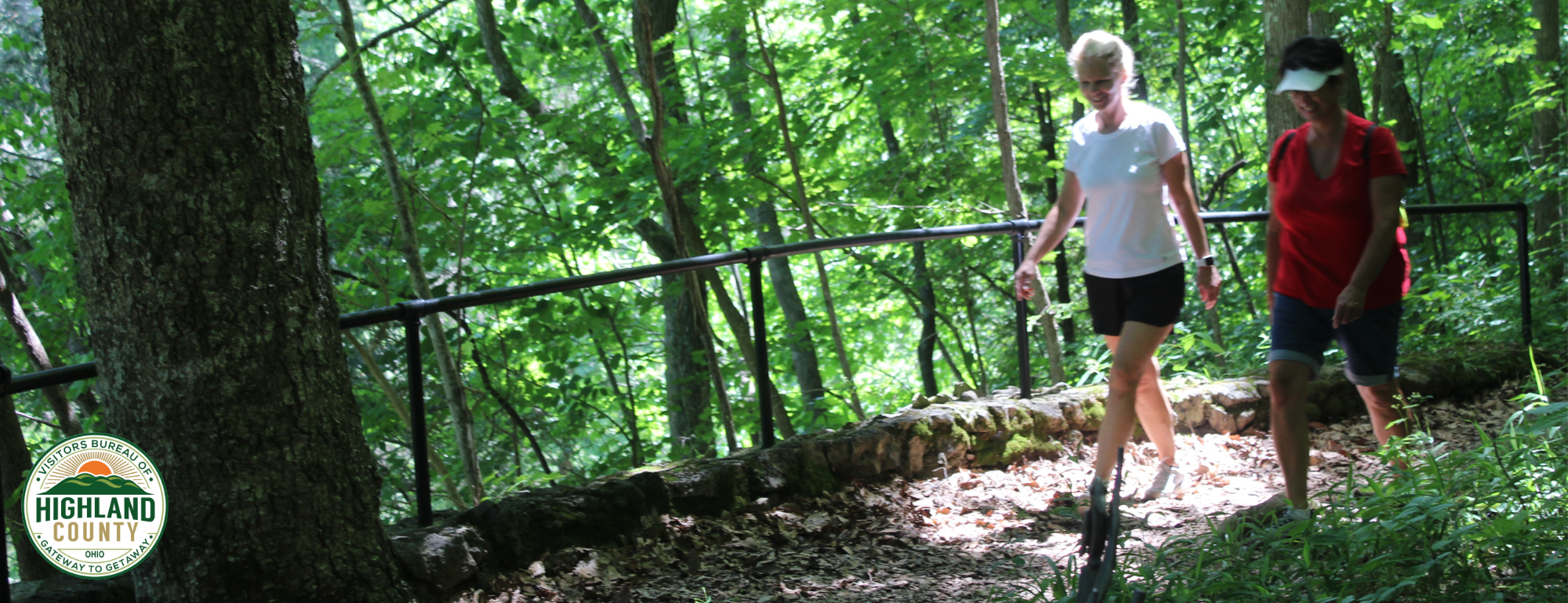
Highlands Nature Sanctuary is a beautiful 2,800-acre preserve for some of the most beautiful wildflower displays in the state of Ohio. The sanctuary is noted for the incomparable Rocky Fork Gorge, a 100 foot high canyon with stunning rock formations, ancient white cedars, grottoes, springs and stone arches. An easy way to enjoy the Rocky Fork Gorge is to hike the Valley of the Ancients trail about a half-mile in length with steps that descend 100 feet from the museum to the creek. Along the trail, hikers will have a chance to see Virginia Bluebells, Hepatica, Snow Trillium, Bloodroot, Wild Ginger, Wood Poppy, White Trillium and other species of stunning wildflowers. With 16 miles of nature trails that are open to the public from April through October from 9 a.m. to 5 p.m., the Highlands Nature Sanctuary is free to visitors who stop at the Appalachian Forest Museum to pick up a free daily hiking pass to access the trails. Caves on the property, once a popular tourist destination, have been restored to their natural state and provide refuge for four species of bats. Overnight accommodations are available at Highlands Nature Sanctuary and can be reviewed and booked online at www.arcofappalachia.org.
Forest Museum Trailhead — 3 trails
Trailhead closed to the public and members November-March.
Directions: The Forest Museum is one mile south of Hwy 50 on Cave Road. The parking entrance is on your left, across from the Museum. These relatively short Museum trails are some of the most stunning trails in all the Sanctuary. See special hours below.
Etawah Woods Trail: 1.2 mile moderate trail begins at Museum
Valley of the Ancients: 0.5 mile moderate trail begins at Museum
Barrier Ridge Trail: 3.0 mile moderate to difficult loop. A long gradual climb up to the top of Barrier Ridge with a faster descent. We recommend carrying this map and your cell phone since sometimes the route is difficult to find in autumn when the leaves have just fallen. The trail begins in the lower elevation parking lot west of the Museum. Look for a set of stone stairs on the right hand side in the middle of the lower parking lot. Do not begin this trail after 1 pm to ensure return before the parking lot closes.
Barrett’s Rim Trailhead — 2 trails
Directions: Follow Cave Road south until you pass Browning Road on the right. Turn into the very next parking lot on the right. It is a gravel parking lot with a wooden fence at its entrance.
Barrett’s Rim Trail: 2.5 mile moderate loop. A mostly level trail with one short descent and ascent. The trail follows the Rocky Fork Creek along the base of a vertical rock wall. The area is often referred to as the “Jewel of the Rocky Fork Gorge.”
Roundtop Loop: 1.75 mile moderate loop. Roundtop winds through a rich sugar maple forest and through a chestnut oak shale barrens. The trail makes a gradual climb to the ridgetop and back down.
Cedar Run Trailhead — 1 Trail
Directions: Turn left onto Hwy 50 from Cave Road and follow Route 50 for 3 miles. After you pass Browning Road on your left, look for a gravel parking lot on the left in front of an old silo. The trail begins at the parking lot.
Cedar Run Trail: 2.5 mile moderate loop. Trail begins by following an old farm lane into an open meadow and then enters the woods as it continues to the Cedar Run Gorge. Trail provides beautiful views of rock walls and fern-covered boulders along spring-fed Cedar Run. A spur leads to a small waterfall nearly hidden by a fallen rock.
Miller State Nature Preserve — 3 trails
Owned and Operated by Ohio Division of Natural Areas & Preserves
Directions: Follow Cave Road south until it dead ends, then turn right on Barrett’s Mill Road. Cross over the Rocky Fork Creek. Miller’s parking lot, which is signed, will be on the right, midway up the first hill. Drive or walk down the long lane to the trailhead. Miller boasts classic Rocky Fork scenery with rock-scapes, sparkling streams, and spring flowers. Three trails are available for hiking: the Falls Trail, a 1 mile moderate loop, the Tuliptree Trail, a 0.75 mile easy to moderate loop, and the Arch Trail, a 0.5 mile moderate loop.
Kamelands Trailhead — 1 trail
Directions: Follow Cave Road north to Hwy 50 and turn left (west). The parking lot is exactly 0.5 miles down the road on your right. Park near the old barn and walk towards Hwy 50. To the right of the driveway a trail sign leads you underneath Hwy 50 through an old cattle tunnel and onto the Kamelands Trail.
Kamelands Trail: 2 mile moderate loop. Mostly level trail. This trail leads through rolling meadows to the wooded corridor bordering the high bluffs of Rocky Fork Creek, directly across the gorge from the Forest Museum. This trail boasts immense ancient oaks, interesting rock formations, and an optional spur trail down to the canyon floor.
Crow Point Trailhead — 1 trail
Directions: Follow Cave Road north. Just before you reach Hwy 50, turn right at the mowed entrance. The parking lot is signed.
Ashy Sunflower Trail: 1 mile easy loop, mostly level. This trail runs through a planted prairie that is stunningly beautiful in early- to mid-August when the rare but showy ashy sunflower bloom. Dog Friendly - but must be on a 6-foot leash.
Ridgeview Farm Trailhead — 1 trail
Farm Restoration Model and American Chestnut Demonstration Orchard
Directions: Follow Cave Road north to Hwy 50. Turn left. One mile west of Rainsboro on Hwy 50, turn south onto State Rt. 753 at the blinking yellow light. After 1.8 miles, turn left at the sign for Beaver Cemetery on a gravel lane. Keep left at the fork and follow the lane back to the cemetery, where you can park. Trail entrance is signed.
Ridgeview Farm’s Restoration Trail: 1.5 mile easy to moderate loop trail features educational signs interpreting the biodiversity-boosting practices that are taking place on this old farmland. The trail winds through gently rolling open fields and into a swamp forest that shelters skunk cabbage and marsh marigolds. Along the trail is an Educational Chestnut Orchard featuring three species of chestnuts and blight resistant F-3 hybrids. Listen for orchard orioles and the rare Henslow’s sparrow, Ridgeview’s signature birds. This preserve exists to demonstrate that restoring biodiversity is possible on an abandoned farm.
Sanctuary West Trailhead — 1 trail
Directions: Follow Cave Road north to Hwy 50. Turn left. One mile west of Rainsboro, turn south onto State Rt. 753 at the blinking yellow light. Follow OH 753 for 2.8 miles. The mowed lot will be on your left, on a lower elevation than the road. Use caution when leaving the parking lot - this is a blind exit.
Listening Trail: 0.5 mile moderate to difficult trail following the bluffs of the Rocky Fork with a spur down to the creek. Gorgeous views of the Rocky Fork Creek and handsome rock formations.
Maude’s Cedar Narrows Trailhead — 2 trails
Directions: Follow Cave Road north to Hwy 50. Turn left. One mile west of Rainsboro, turn south onto State Rt.753 at the blinking yellow light. 1.2 miles down 753 turn right onto McCoppin Mill. Follow McCoppin Mill for another 1.3 miles. After crossing over the Rocky Fork Bridge, take the next left on Skeen Road. Follow Skeen around the bend. When the road straightens, (at the 0.3 mile mark), turn onto the first lane on your left. Look for tall hickory trees shading the trailhead parking lot.
Prothonotary Trail: 0.5 mile moderate loop with a descent into the canyon floor and back up along the rim. Gorgeous views of the Rocky Fork Creek, rich spring wildflowers, and interesting rock formations.
Maude’s Cedar Narrows Trail: : 1.5 mile moderate loop with a 50-foot rise and fall in elevation. Maude’s comes off the right loop of Prothonotary Trail and returns to the trailhead parking lot. The trail follows the foot of the bluffs overlooking the Rocky Fork Creek, then up Franklin Branch tributary. Marvelous spring wildflower displays and rock formations. Great grassland birding on the return route.