Miller State Nature Preserve
7660 Cave Road,
Bainbridge, Ohio 45612
Bainbridge, Ohio 45612
Directions: Follow Cave Road south until it dead ends, then turn right on Barrett's Mill Road. Cross over the Rocky Fork Creek. Miller's parking lot will be on the right, midway up the first hill, and is signed. Drive or walk down the long lane to the trailhead, which begins at the second parking lot. Miller boasts classic Rocky Fork beauty with several bridges, sparkling streams, and spring flowers. Three easy trails are offered.
Miller State Nature Preserve: Experience this 3.0-mile out-and-back trail near Bainbridge, Ohio. Generally considered an easy route, it takes an average of 1 h 9 min to complete. This trail is great for birding, hiking, and running, and it's unlikely you'll encounter many other people while exploring. You'll need to leave pups at home — dogs aren't allowed on this trail.
Arch Trail: The Arch Trail is a short trail that features views of rock formations and the Rocky Fork Creek. This natural bridge is made out of Peebles dolomite, which is what most of Ohio's natural arches are formed out of. Geologically, these arches are formed when a crevice parallel to a cliff face has widened until it cuts through the roof of an alcove which is carved out by a water feature.
The Arch Trail is the shortest and easiest of the Miller Nature Sanctuary Trails. Only 1/3 of a mile in length, the Arch Trail passes directly below its namesake, which is more accurately a natural bridge than an arch. The bridge was formed as surface water running downslope and over the cliff, became captured by a vertical joint in the bedrock. This joint (or crack) was slowly enlarged by the dissolving action of the surface water until all the water running down the slope flowed through the joint and under the bridge that we see today. The bridge stretches forty-six feet wide and three and a half feet high.
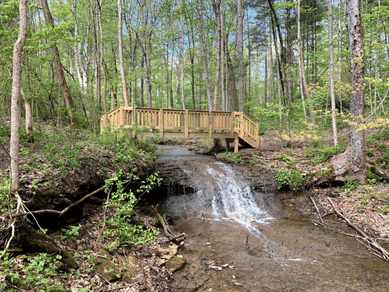
Tuliptree Trail: The Tuliptree Trail, located along the Miller State Nature Preserve Trail, is 0.75 miles long. Generally considered an easy walk, this trail boasts classic Rocky Fork scenery with rock-scapes, sparkling streams, and beautiful spring flowers.
This 3/4 mile trail leads visitors upstream along a small tributary of Rocky Fork. The stream bottom here is solid dolomite and forms a waterfall near the beginning of the trail. The Tuliptree Trail loops through a stand of tuliptree (Liriodendron Tulipifera) so named because of the tulip-like flowers produced by the tree in late spring and early summer. The flowers usually are high in the tree tops and difficult to see, but the orange and green "petals" are often found on the ground beneath the trees.
Falls Trail: The Falls Trail, located along the Miller State Nature Preserve Trail, is a 1 mile long loop. Generally considered a moderate walk, this trail boasts classic Rocky Fork scenery with rock-scapes, sparkling streams, and beautiful spring flowers.
At one mile in length, the Falls Trail is the longest hiking trail at the Miller Nature Sanctuary. The Falls Trail follows Rocky Fork downstream to the extreme northeastern end of the preserve, passing its namesake near the half-way point. A small tributary enters from the north and tumbles over the gorge wall forming an impressive waterfall during wetter times of the year. Colorful displays of wildflowers abound along the lower section of the Falls Trail in the spring.
Overview
- Closest City: Bainbridge
- Region: Northeast
- Category: Things to Do
- Sub-Category: Outdoor Adventure, Attractions